Bloor Homes Logo

Land at Craythorne
Road, Stretton

Welcome to our website, where you can discover more information about our emerging proposals for a new residential development on the northern edge of Stretton.

Our emerging proposals for the land at Craythorne Road, will provide distinctive, high quality new homes which fits sensitively and enhances the qualities and character of Stretton. The site will bring forward a sustainable and energy efficient new development that will help to meet local housing need in a way that is responsive to the surrounding local area.

Please explore this website to find out more about our emerging proposals and how to comment. You can also find answers to the questions we have been asked in the Q&A section. The various consultation materials will be added, as they become available, in the library section, including a recording of the public webinar.

If you would like to receive email updates about this project, please sign up to our mailing list using the Register button below.

Public Consultation Events

We have hosted 2 public consultation events and the materials we have shared including the recording of the webinar can be found in the library section.

Thank you to everyone who joined us at our events, and we would like to remind you that the deadline for your comments is midnight on Friday 25th July 2025.

Attend the Public Exhibition

  • July
    9
    Wednesday 9th July 2025
  • 2.00pm to 7.00pm
  • Stretton Social Club
    Beech Lane
    Stretton
    Burton on Trent
    DE13 0DU

Join the Public Webinar

  • July
    10
    Thursday 10th July 2025
  • 6.00pm to 7.00pm
  • Presentation will start at 6pm followed by a Q&A session.

Location & Background

The site is located to the south of Craythorne Road, northwest of Stretton, and is approximately 2 miles north of Burton-upon-Trent town centre.

The Site

The site is sustainably located with easy access to the village centre, existing community amenities and the public transport network. These amenities, which are less than 800m from the site, include local shops, a community centre, parks, schools, pubs and medical facilities within Stretton.

In total, the site measures approximately 23.31 hectares (ha) and is currently in agricultural use. The site has a strong relationship with the existing settlement of Stretton, by being surrounded by existing housing to its northern, eastern, and southern boundaries. The western boundary is bounded by the former Golf Course (The Craythorne Golf Club), which closed in 2013 and is currently disused open space.

  • View from halfway along Craythorne Road along the eastern boundary

    View from halfway along Craythorne Road along the eastern boundary (click to enlarge)

  • View from halfway along Craythorne Road along the northern boundary.

    View from halfway along Craythorne Road along the northern boundary (click to enlarge)

  • Location plan showing site boundary

    Site location plan (click to enlarge)

  • Location plan showing site boundary

    Local Context Plan (click to enlarge)

Background

Bloor Homes

Bloor Homes was founded in 1969 by John Bloor and remains privately owned by the Bloor family. We have more than 50 years' experience building high-quality new homes across the country. We give thorough consideration to the communities in which we build to create beautiful places that provide a variety of new homes, while respecting local character, preserving natural amenities and protecting existing wildlife habitats wherever possible.

Bloor Homes has a proven track record of delivering high-quality new homes in the West Midlands. We have taken the time to understand the unique characteristics of the site and are committed to creating a thriving community that we would love for ourselves, or our family and friends to live in.

You can find out more about Bloor Homes here >

Collage of bloor homes corporate images

94%

of our homeowners would recommend us

92%

of our homeowners are happy with the build quality of their new homes

90%

of our homeowners enjoyed our home buying process and experience

5-star Home Builders Federation rating for six years

A member of the Homes for Nature scheme

Rated Excellent on Trustpilot with over 3,500+ five-star reviews

The Planning Process

In due course, we are looking to submit an Outline Planning Application with all matters reserved except for access for the Site. We know that sometimes the planning process can be confusing, so we thought it might be helpful if we briefly explained the Planning Application process.

An Outline Planning permission establishes the principle of development subject to it meeting certain parameters. The detailed design will then need to adhere to these approved parameters and be subject to a separate Reserved Matters approval at a later date. East Staffordshire Borough Council, as the Local Planning Authority, will therefore maintain control over any subsequent detailed design Reserved Matters applications.

Our Outline Planning application will seek to agree the following parameters:

  • Maximum extent of developable footprint/no build zones.
  • Maximum heights of buildings.
  • Landscape and open space strategy.
  • Density.

The Reserved Matters application will cover the following elements in full detail:

Final design

  • Site layout.
  • Massing.
  • Appearance and materiality.
  • Boundary treatment e.g. fencing and lighting.

Amenity

  • Car parking.
  • Cycle parking/storage.
  • Bin storage/refuse strategy.
  • Landscaping and open space/play area design.
  • Detailed access within the site and street road design, including lighting.
  • Design of pedestrian and cycle routes.
model of a construction of a house

Planning Policy Context

The East Staffordshire Local Plan was adopted in October 2015 and covers the plan period of 2012-2031.

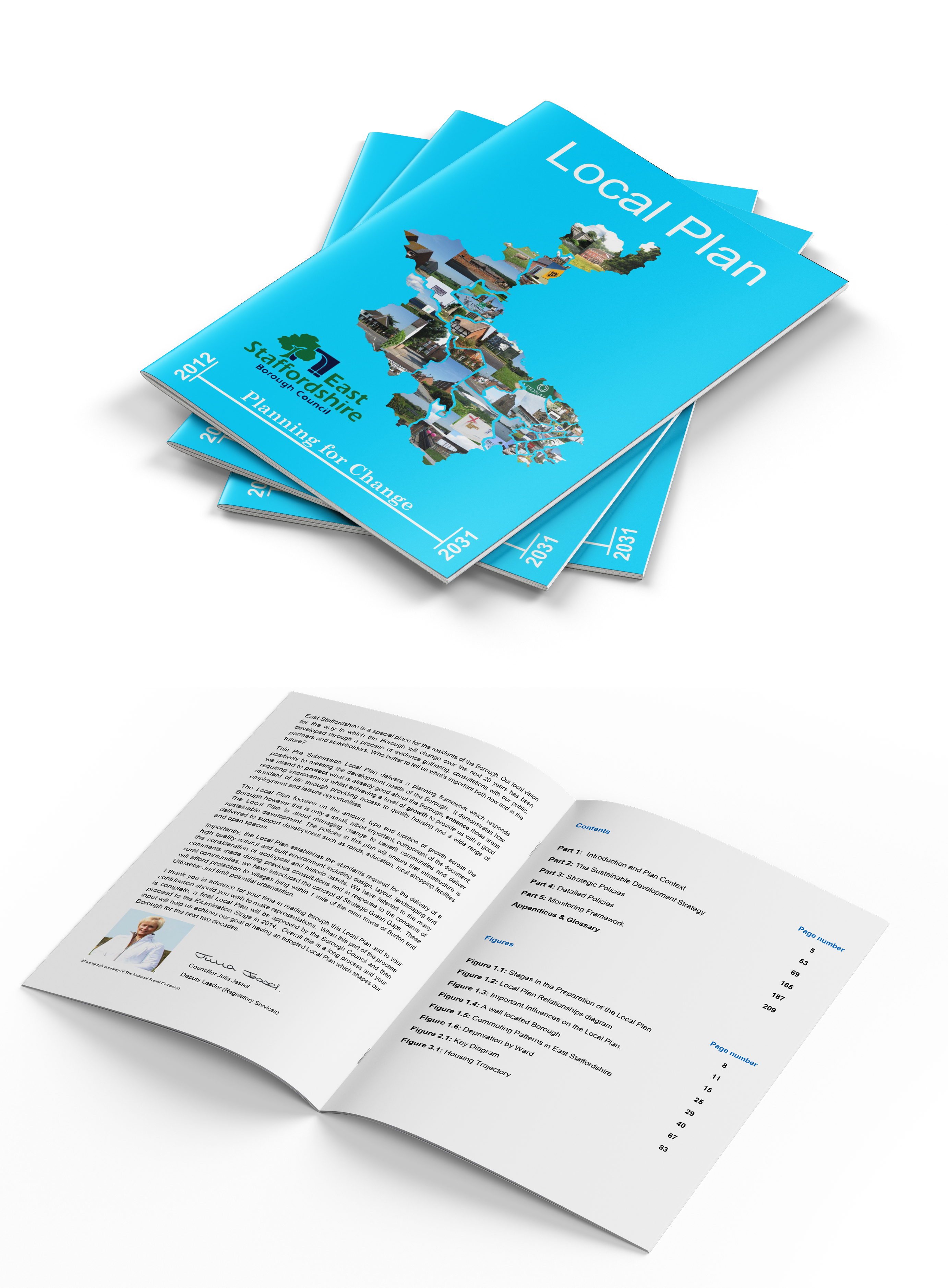
The Local Plan Vision sets out that East Staffordshire’s communities will be well planned, vibrant, safe and inclusive. Quality housing will be available with a variety that meets the needs of all sectors of the community and the aspirations of a growing population.

The East Staffordshire Local Plan was reviewed at an Extraordinary Council meeting on 19th October 2020. The review concluded that the Local Plan was up to date, and the update to the Local Plan be delayed for a maximum of 5 years (i.e. up to 19th October 2025) with annual reviews carried out.

The latest available annual review (date of decision 10th October 2024) determined that the Local is in date and is fully effective for decision making. There is no requirement to update the Local Plan at this time. Since this time, the government has set a new national housing target and published a local housing need figure for East Staffordshire Borough, alongside a revised National Planning Policy Framework (also referred to as the NPPF) in December 2024.

To deliver the Vision for the Borough, twelve strategic objectives have been formulated, including:

SP2 ‘Settlement Hierarchy’

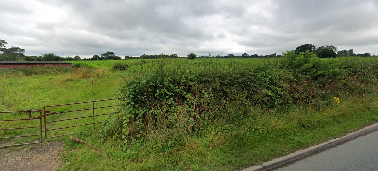
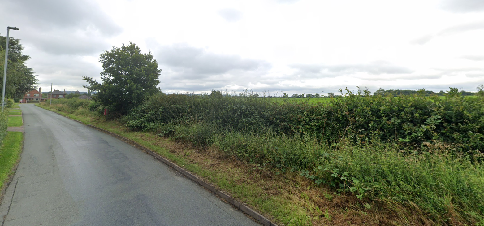
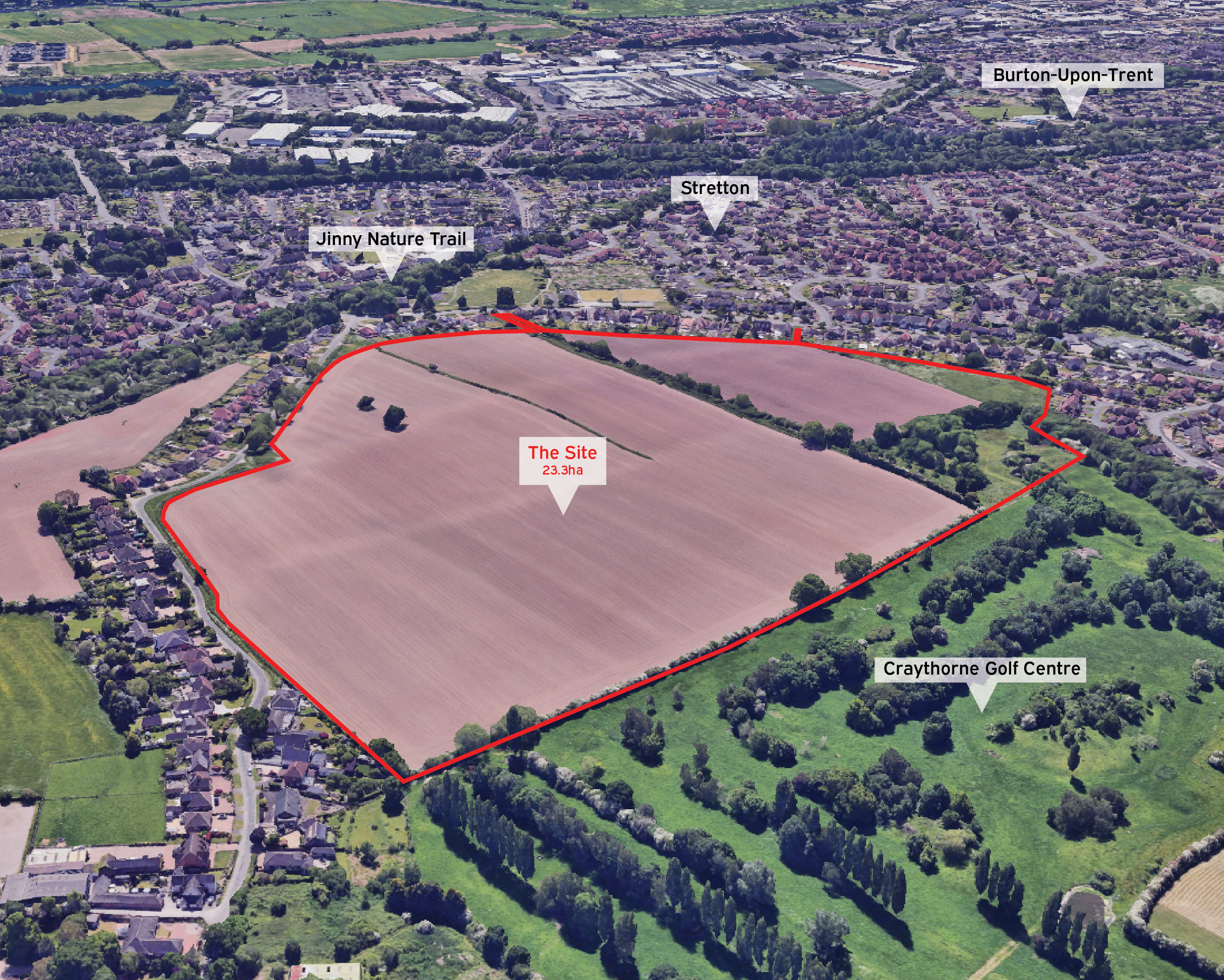
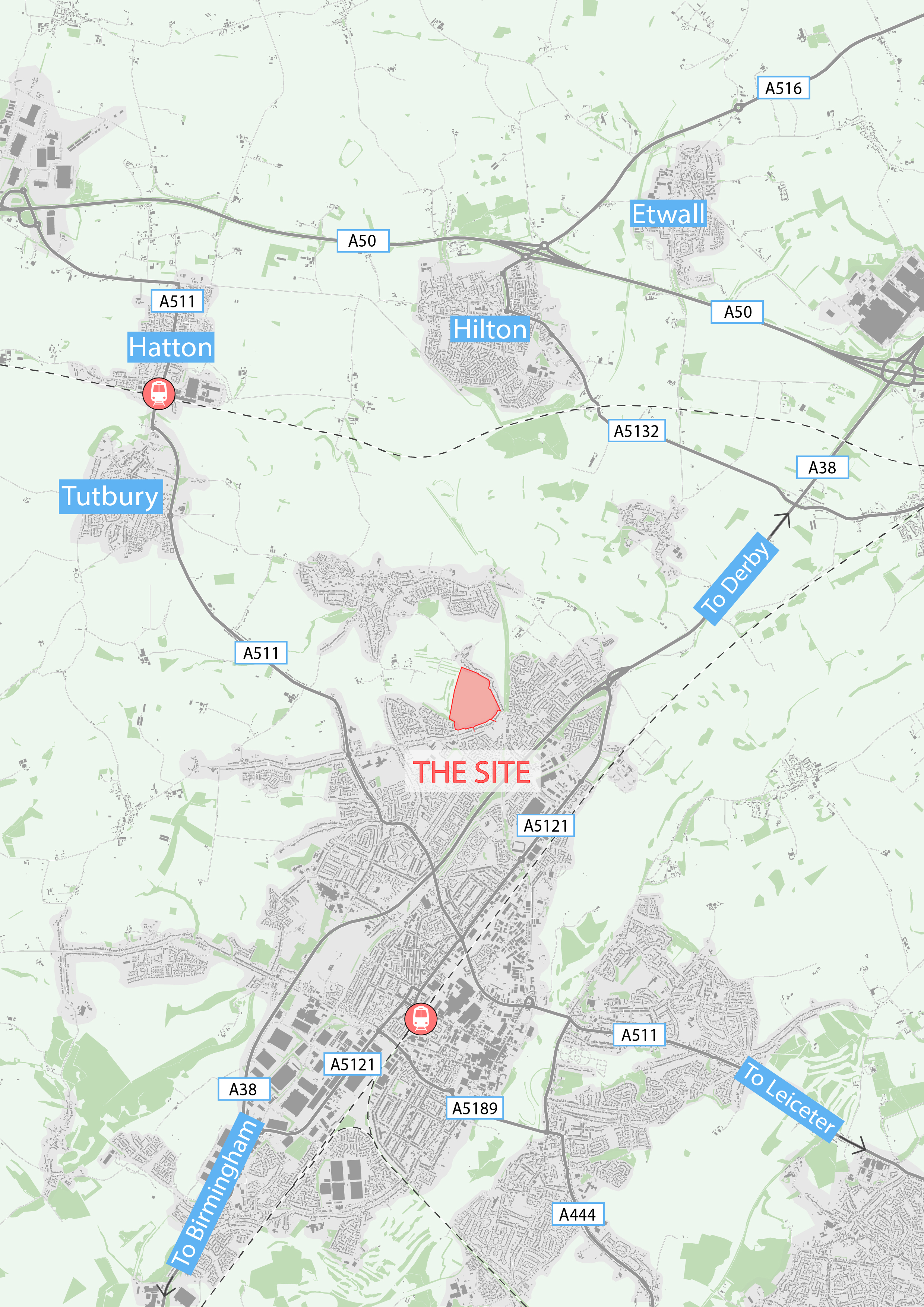
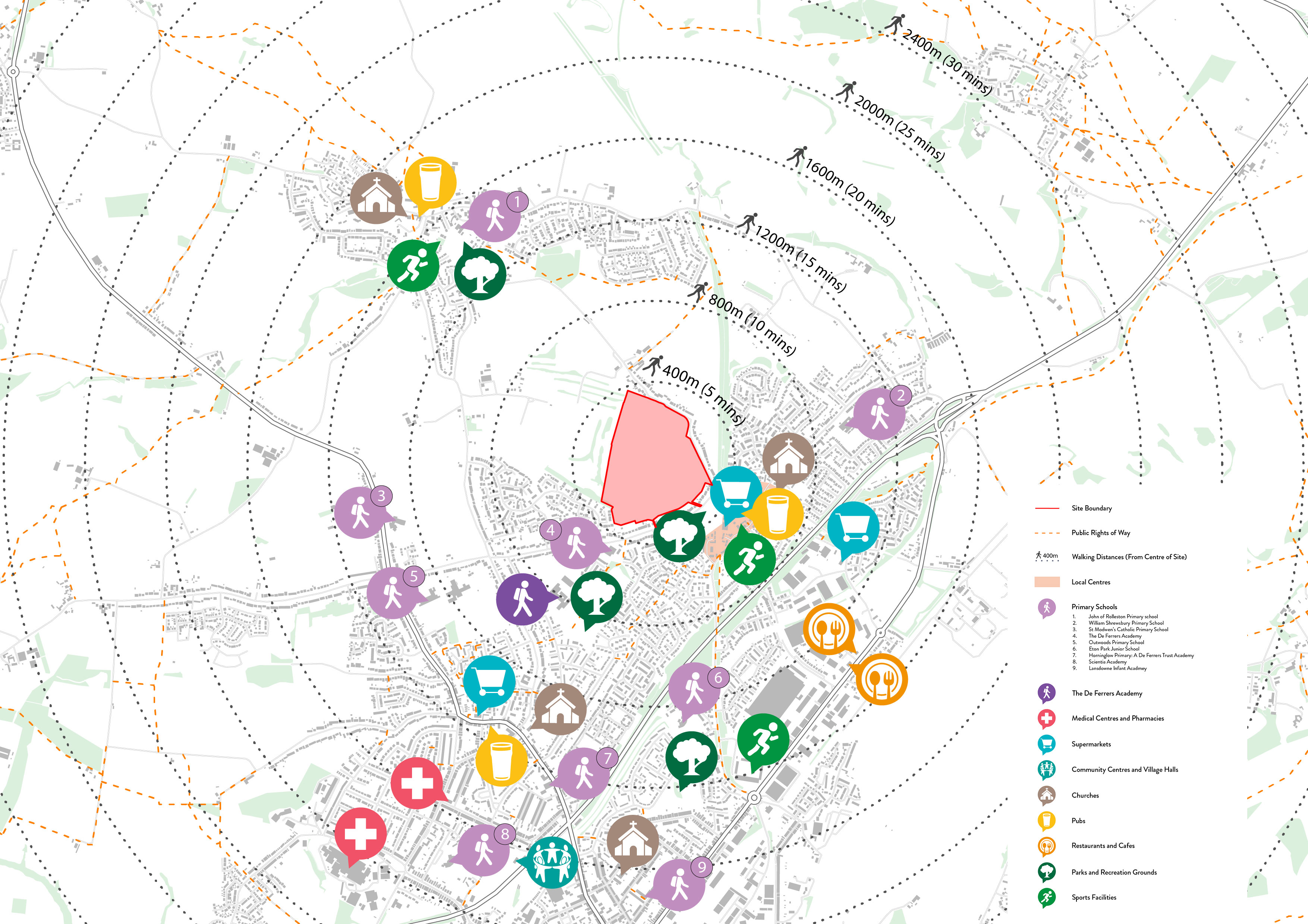
Development will be directed towards the most sustainable locations in accordance with the settlement hierarchy. The site is located adjacent to the settlement boundary of Burton upon Trent which is the most sustainable location in the Borough. The Site is not within a Strategic Green Gap (SP31).

SP3 ‘Provision of Homes and Jobs 2012 – 2031’

The December 2024 National Planning Policy Framework (‘NPPF’) introduced a new Standard Method for calculating local housing need - making the Standard Method for assessing local housing need (‘LHN’) mandatory; reversing other changes to the NPPF made in 2023 which were detrimental to housing supply, to support this Government’s ambition to build 1.5 million new homes in this Parliament.

The Local Plan identifies a housing need figure. This requirement pre-dates the new NPPF. Since the Local Plan is now more than five years old, the Standard Method is used to calculate Local Housing Need in accordance with Paragraph 78 of the NPPF.

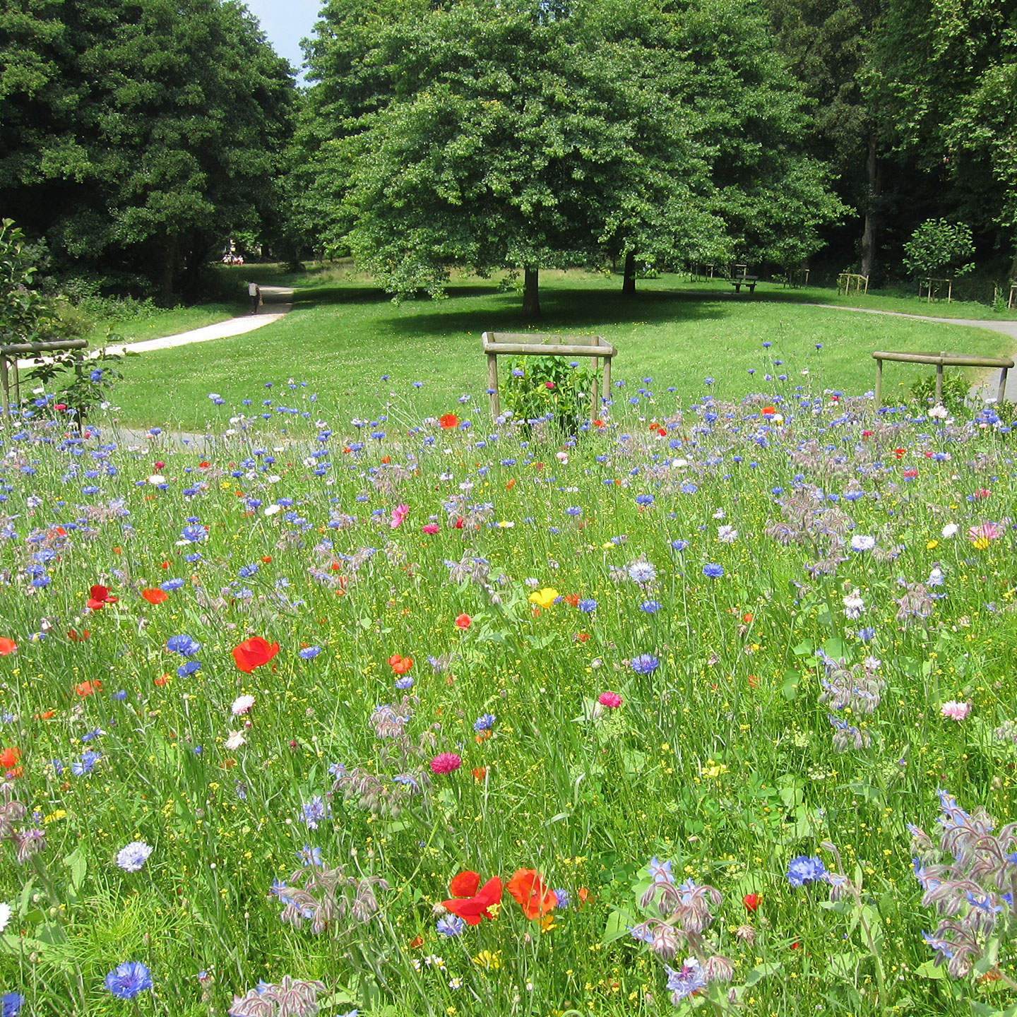
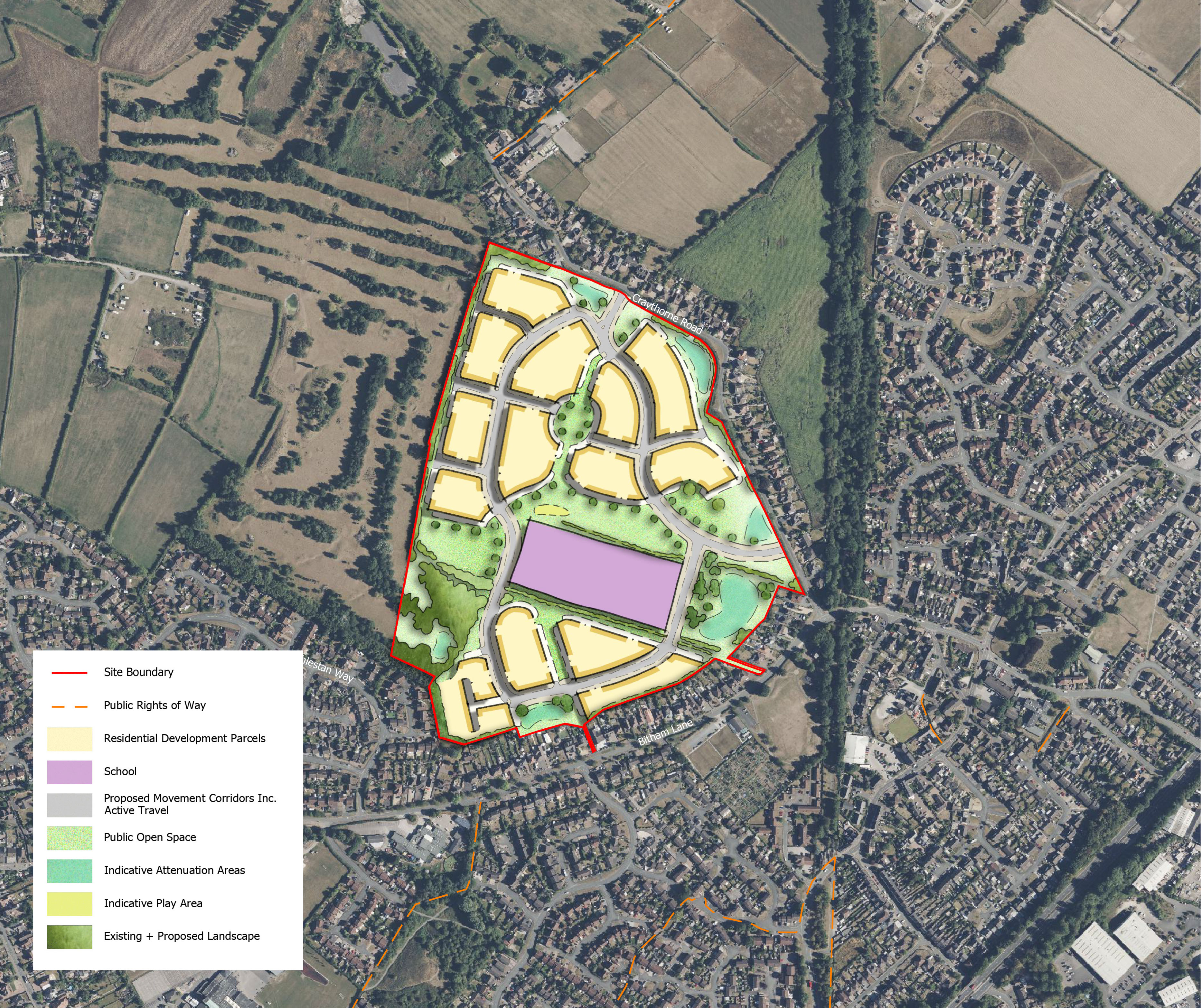
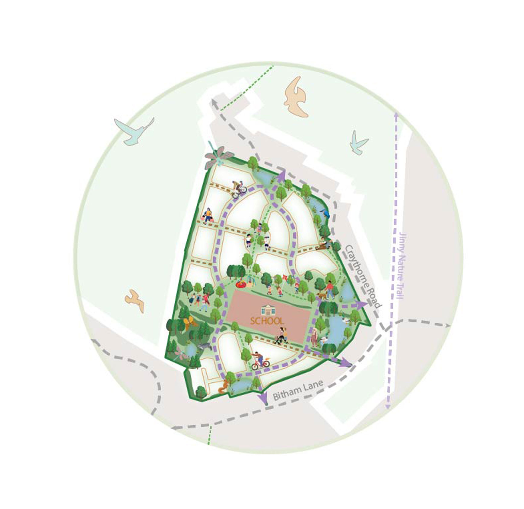
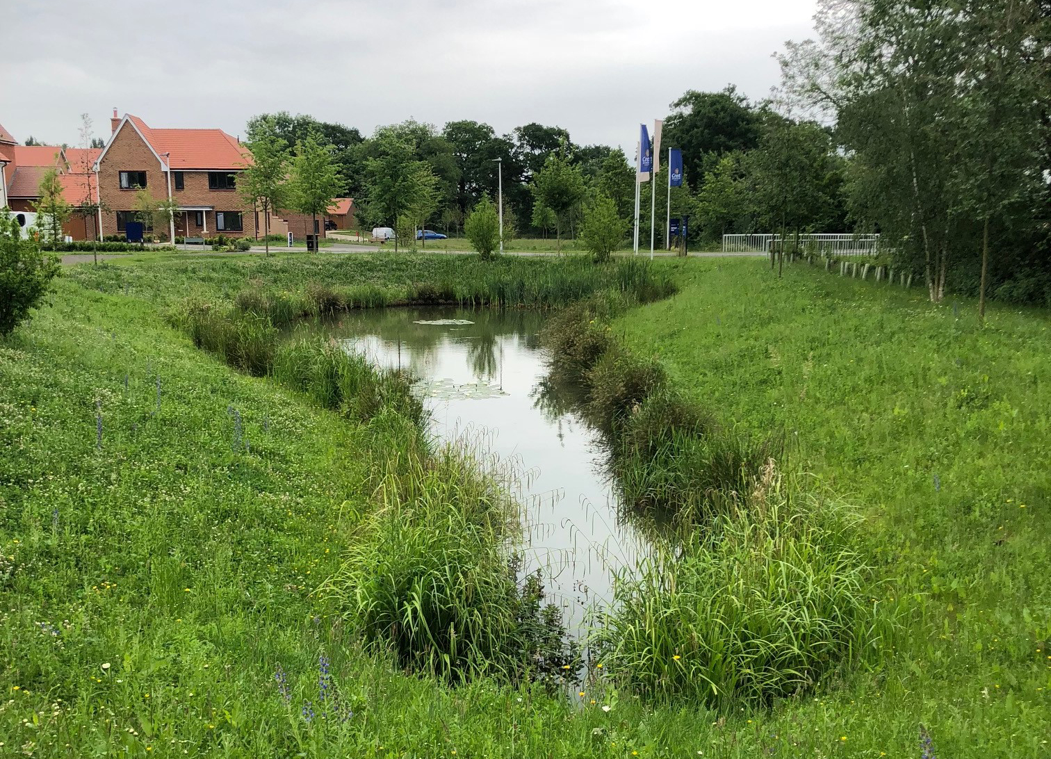
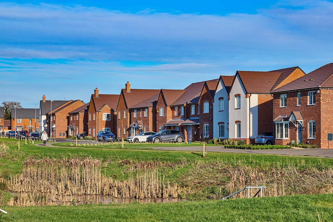
In addition, there is a need for affordable housing to be met. The site is well located adjacent to the existing urban area and in a sustainable location, to meet this market and affordable housing need. This new housing would be delivered alongside green and blue infrastructure, children’s play space and amenity space. This will also include 10% biodiversity net gain provision.

S01 Well Designed Communities - To develop green infrastructure-led strategic housing growth providing well designed communities that provide accessible green space, services and facilities, promote distinctiveness, wellbeing, whilst protecting and enhancing sensitive environments.

S02 Housing Choice – To provide a mix of well designed, sustainable market, specialist and affordable homes that meet the needs of existing and future residents given ongoing and expected population change in the Borough.

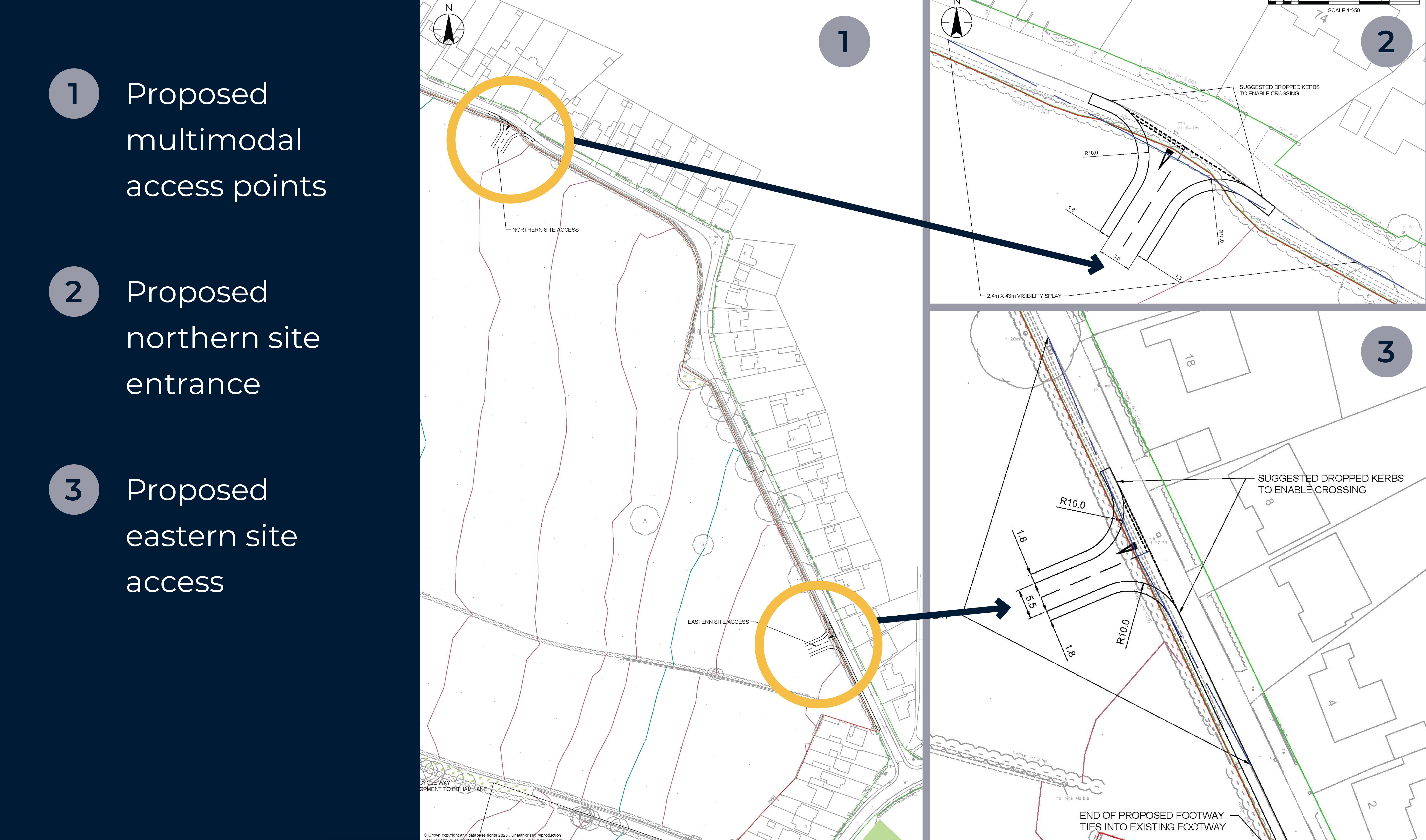
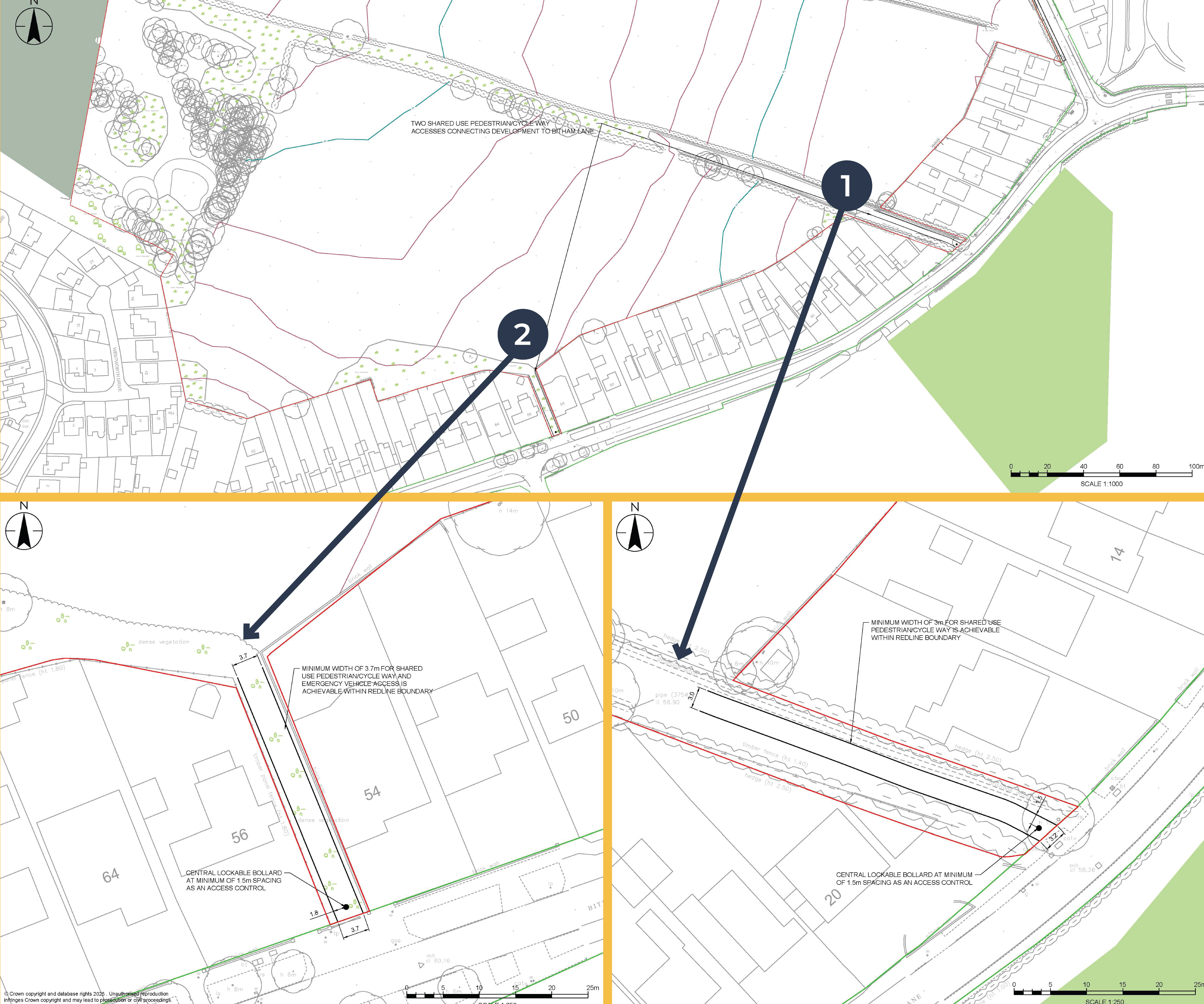
SO3 Accessibility and Transport Infrastructure – To ensure that new development will be supported by effective transport infrastructure and wherever possible, designed in a way that reduces the need and desire to travel by car through encouraging the use of public transport, walking, cycling and rail travel.

National Planning Policy Framework

Stretton Neighbourhood Development Plan -2014-2031

The Site falls within the boundary of the Stretton Neighbourhood Development Plan (2014-2031) area which was adopted in February 2016. The Plan includes a vision, objectives and planning policies.

Policy S2 ‘Protecting Landscape Character’

Development proposals should recognise and seek to protect and enhance the local historic environment character zones identified in Map 4. Development proposals should seek to retain mature or historic hedgerows of recognised importance. Where feasible, these trees and hedgerows should be incorporated into landscaping schemes and where removal is necessary, a replacement of similar species and/or amenity value should be provided on the site.

Policy S3 ‘Protection and Enhancement of Local Wildlife’

Any proposals for new development will be required to demonstrate how the design has taken into account its potential impact on local habitats and species. Developers will be required to ensure that appropriate measures are put in place to protect wildlife and enhance biodiversity and important habitats.

Policy S7 ‘Protecting Archaeology in Stretton’

impact upon above and below ground archaeological deposits and identify mitigation strategies to ensure that evidence which could contribute to our understanding of human activity and past environments are not lost.

Stretton Neighbourhood Development Plan

Key Development Priorities

We have three key development priorities that underpin our vision to create sustainable places, while respecting local character, preserving natural amenities and protecting existing wildlife habitats wherever possible.

Image of british hedgrow

Modern and Energy Efficient Homes

Reduce carbon emissions.

Improve energy efficiency.

Prioritise low-carbon heating and on-site energy production.

Homes built to Future Homes Standards.

Images of child climbing logs

Landscape and Ecology Enhancements.

Enhance and create planted areas.

Committed to Homes for Nature, a voluntary initiative to include a commitment to provide one bird-nesting brick for every new home built and hedgehog highways on all new developments.

Achieve at least 10% Biodiversity Net Gain, in accordance with Government requirements.

Retain trees and hedgerows along site boundaries.

Images of wild planting

Active Travel and Sustainable Transport

Access to various public transport services.

Electric car charging points.

Encourage the use of walking and cycling, by proposing shared pedestrian and cycle routes within the site and connections with the immediate surrounding area and amenities.

Emerging Proposals

Our emerging masterplan shows where we think the new homes, a new site for a potential primary school , access routes and public open space could be delivered on the site.

Emerging masterplan showing possible locations of the new homes, public open space, vehicle access and pedestrian and cycle connections
Emerging masterplan showing possible locations of the new homes, primary school, public open space and vehicle access (Click to Enlarge).

We are still in the design stage but currently our emerging plans could provide:

  • Up to 430 new energy-efficient homes with low-carbon heating, offering a range of house types, tenures and sizes to suit local housing need, including affordable homes – fully compliant with ESBC policy.
  • Up to 2ha of safe guarded land for a new Primary School.
  • Two main vehicle, cycle and pedestrian access points off Craythorne Road.
  • Two additional pedestrian and cycle routes off Bitham Lane.
  • Access to the Public Right of Way (PRoW) network.
  • Car parking spaces, including reduced mobility and visitor parking spaces - compliant with ESBC’s Parking Standards Supplementary Planning Document.
  • Private gardens and/or amenity space for every home.
  • Provision of multi-functional public open space, natural play and recreational routes - accessible by existing and new residents.
  • Sustainable Drainage Systems (SuDS) and flood alleviation features.
  • EV charging points for every home.
  • A minimum of 10% Biodiversity Net Gain (BNG).
  • Pedestrian and cycle links throughout the site with connections to the immediate surrounding area and amenities.
  • Retention of all significant existing trees and retention of hedgerows, where possible.

Access, Sustainable Transport and Connectivity

Access

We are proposing to create two new multimodal accesses, in the form of priority junctions, onto Craythorne Road, with footways provided on either side of the junctions.

  • Northern site access approximately 470m north of the Craythorne Road/Bitham Lane junction.
  • Eastern site access approximately 80m north of the Craythorne Road/Bitham Lane junction.
Images of train station, family cycling, hedgerows and man on electric scooter
Proposed Pedestrian and Cycle Only (click to enlarge)

Pedestrian and Cycle Routes

Footways will be provided on either side of the two main multimodal access junctions off Craythorne Road.

A further two footways are proposed on Bitham Lane.

  • The proposed footway (one on the map) will continue south on the western side of Craythorne Road, connecting it to the existing footway on Craythorne Road towards the Bitham Lane junction.
  • The provision of this footway (two on the map) will connect the site to Bitham Lane and provide onward access to facilities and amenities within Stretton. This is also proposed to serve as an emergency access.

A network of footways will be provided within the site that will connect the to the four points of access. It is anticipated that cyclists will travel on-road to the site, as per the existing arrangement and bicycle storage will be provided for each new home.

Parking Provision

The exact parking quantum will be determined as part of future Reserved Matters applications, but each home will have access to car parking spaces and/or garages. The number of car parking spaces including reduced mobility and visitor spaces will be in full compliance with ESBC’s Parking Standards Supplementary Planning Document. Cycle parking will also be provided in line with the adopted standards, with adequate parking provided for both residents and visitors.

Local facilities plan
Proposed multimodal access points (click to enlarge)

Sustainable Transport and Connectivity

Bus

The closest bus stops to the site are located on Bitham Lane (approximately a 4-minute walk from the centre of the site), served by routes1 and 17. Additional bus stops on Church Road (approximately a 7-minute walk from the centre of the site) are served by the V1 the Villager service, with frequent services into Burton-upon-Trent town centre across all three routes. Details of these services are listed below:

  • The ‘1’ bus route runs between Burton-upon-Trent and Tutbury with a daytime frequency of approximately 1 bus every hour Monday to Friday.
  • The ‘17’ bus route runs between Stretton and Burton-upon-Trent with a daytime frequency of approximately 1 bus every hour Monday to Friday and three times per day on Saturdays.
  • The ‘V1 Villager’ bus route runs between Derby and Burton-upon-Trent with a daytime frequency of approximately 1 bus every half an hour Monday to Saturday and 1 per hour on Sundays.

Train

The closest train station to the site is Burton-on-Trent, located approximately 2.2 miles (a 7-minute drive or 16 minute cycle) from the site.

Burton-on-Trent is a major railway station offering regular services to major towns and cities including Nottingham, Derby and Tamworth, with CrossCountry services southbound to Plymouth via Birmingham, Bristol and Exeter and northbound to Edinburgh via Derby, Sheffield, Leeds, York and Newcastle.

Trains to Birmingham New Street run approximately every 30 minutes and those to Nottingham run approximately every 10-20 minutes. Services to destinations further afield such as Edinburgh, Plymouth and Cardiff Central are less frequent.

Walking/Cycling

The site is located within proximity of a number of Public Rights of Way (PRoW).

The walking / cycling facilities proposed on site will not only benefit residents of the development but also existing residents along Craythorne Road or those using the local PRoWs wishing to travel south towards Burton-upon-Trent.

A network of footways will be provided within the site that will connect the four points of access.

Connectivity

The site is advantageously located within an accessible and well-connected area that has excellent pedestrian, cycle and public transport links providing access to significant local and regional destinations, including Stretton town centre (approximately 800m from the site), as well as local shops, supermarkets, a community centre, parks, schools, pubs and medical facilities.

Indicative image of proposed drainage feature
Local Facilities Plan (click to enlarge)

Landscape and Ecology

Promoting healthy lifestyles and wellbeing by connecting people with nature and wildlife are key drivers behind the landscape design.

A sympathetic landscape design taking consideration of the existing planting and habitats, with the majority being retained and strengthened, to protect the existing green infrastructure and habitat network. The landscape proposals create a pleasant transition between the residential development and the local landscape, where the built form will work around the existing vegetation, reinforcing the local character and retaining the important views in Stretton.

Emerging Landscape Plan
Emerging Landscape Plan (click to enlarge)

The public open space will include a range of planting and experiences with the following features:

Image of british hedgrow

Green Infrastructure

The landscape proposals are to enhance and strengthen the planting such as hedgerows, trees and shrubs in the Green Infrastructure network.

Images of child climbing logs

Local Character

New native planting will reflect the local character, with new lengths of hedgerow, hedgerow trees, and areas of woodland and additional understory and canopy tree planting.

Images of wild planting

Connectivity

Within the Green Infrastructure network, a series of footpaths / cycleways are proposed to enhance connectivity across the site and with connectivity to the local roads and Jinnie Trail to the south-east of the site.

A community orchard

Green and Blue Infrastructure

There will be a range of public open space consisting of play areas, wildflower meadows, ornamental planting, shrubs and tree which will be integrated with sustainable drainage features as part of delivering Biodiversity Net Gain (BNG).

Drainage

Surface water drainage

Surface water runoff disposal will be managed through Sustainable Drainage Systems (SuDS) that will mimic the site's existing, pre-development response to rainfall. The system aims to collect, slow down flows, and convey surface water across the site prioritizing the use of vegetated conveyance swales allowing for water quality improvement before flowing to the proposed attenuation basins, which will be integrated within the green infrastructure strategy, making attractive features within the open spaces.

SuDS features will be designed to accommodate the design rainfall event (i.e. the 1 in 100-year event with an additional 40% allowance for climate change) to ensure that flood risk will not increase either on-site or off-site due to the development.

Sufficient space for SuDS has been provided within the proposed masterplan which includes several attenuation basins as part of a nature-based SuDS solution which will also deliver biodiversity enhancements through the creation of new habitat features. Control measures to prevent pollution of these ponds and basins will be provided as part of the SuDS strategy.

Foul Water Drainage

It is proposed that the foul sewerage will be delivered through a gravity-based solution - gravity drainage systems operate based on gravitational forces, allowing water to flow from high to lower areas - which will then outfall to the Severn Trent Sewers (STW) at manhole SK24267101 in Bitham Lane to the south of the development. STW have confirmed that the manhole (SK24267101) can accommodate total flows from the site without the need for capacity improvements and this location will be acceptable to them.

Flooding

The site is located within Flood Zone 1, which is the most suitable zone for all development types in terms of fluvial flood risk. The majority of the existing site is at ‘very low’ risk of surface water flooding. All built development (including access) will be located within areas of ‘very low’ risk.

Very low risk from all other potential sources of flooding – tidal, reservoir, groundwater and sewer.

Indicative image of proposed drainage feature
Illustrative examples of SuDS features

Feedback

Thank you for taking the time to explore our website to learn more about the proposed development on Land at Craythorne Road, Stretton.

We would like to hear your views on our proposals, and we would like to assure you that your thoughts, ideas and any concerns you share with us, will only be seen by the project team and will be fully anonymised if included in future material. All the comments we receive will be considered before a planning application for the site is submitted.

For the project team to have sufficient time to consider your feedback, we kindly ask that you let us have your views on our proposals by midnight on Friday 25th July 2025.

Q&A

We are proposing to build up to 430 new homes, including affordable homes, fully compliant with East Staffordshire Borough Council policy.

We are proposing a range of house types, tenures and sizes to suit local housing need with most homes being two-storeys tall.

We are proposing to create two main vehicle accesses including pedestrian and cycle access points from Craythorne Road.

Car parking spaces including reduced mobility and visitor spaces will comply with East Staffordshire Borough Council’s Parking Standards Supplementary Planning Document.

Contributions to offset any potential impact on local services and facilities will be provided as part of any Section 106 agreement with East Staffordshire Borough Council.

As the developer, we have an obligation to produce a Construction Management Plan, which will be submitted before any construction starts on site for approval by East Staffordshire Borough Council. This document outlines how the construction process will be managed and will stipulate the specific times and routes construction vehicles are allowed to enter and leave the site. We will use the strategic network as far as possible to limit any impact on the local roads and residents.

It is not possible to give an exact price range of these homes at the current time. However, if and when the homes come forward, they will be comparable in price to new build properties within the local area at that time – this excludes affordable housing.

Timeline

Throughout the pre-application planning process, we will be in ongoing discussions with planning officers and stakeholders, including the local community, about our emerging proposals to develop the site. The timings set out below are indicative dates only and will be subject to change as we progress through the design and planning process.

  • Monday 7th July 2025 Start of consultation period
  • Wednesday 9th July 2025 Public Exhibition at Stretton Social Club.
  • Thursday 10th July 2025 Public Webinar and Q&A session.
  • Friday 25th July 2025 Deadline for comments. Consultation period closes at midnight.
  • Late Summer 2025 Submission of planning application to East Staffordshire Borough Council.
  • Winter 2025/2026 Submission of planning application to East Staffordshire Borough Council.

Dates of submission and determination are indicative only and will be subject to change.

Library

Contact

If you have any questions, would like some more information or need some help, please do get in touch with the Community Engagement Team:

Send us a message and we will get back to you as soon as we can:

Landatcraythorneroad-stretton@KGCommunications.co.uk

By Phone

If you want to chat to a member of the team, give us a call:

07909 735417
(Monday to Friday – 9.30am to 5pm)